


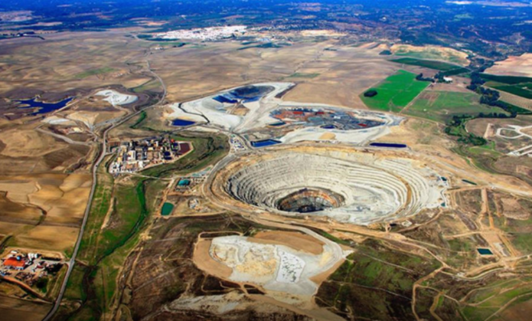
Zambia’s national aerial mineral survey reaches 52.8% completion, enhancing geological data and making the country more attractive to mining and exploration investors.
Zambia’s government has announced that its aerial mineral survey, a cornerstone of its strategy to unlock new mineral discoveries, has now reached 52.8% completion, a major milestone in mapping the country’s subsurface geology. The survey, coordinated by the Ministry of Mines and Minerals Development, uses modern airborne geophysics and remote sensing techniques to identify prospective zones for copper, cobalt, gold, and critical minerals.
By capturing detailed, standardized geological and geophysical data over large swaths of territory, the survey significantly de-risks exploration for investors and mining companies. Officials say this richer data layer will help target drilling, reduce upfront exploration costs, and accelerate discovery timelines, all of which make Zambia a more compelling destination for foreign direct investment (FDI) and junior explorers looking to find new deposits.
The initiative also aligns with Zambia’s broader mining vision: strengthening geological information systems, formalizing artisanal and small-scale mining, and expanding mineral value addition within the economy. As the survey progresses toward completion, government and industry stakeholders hope the results will translate into increased exploration licenses, expanded investment flows, and new mining projects that support jobs and long-term growth.

Leave a Reply